Random pictures, thoughts, and rants.

Random thoughts, pictures, and rants: Mainly from me, but maybe from the dogs if they figure out how to type.

Tuesday, June 29, 2010

I haven't forgotten to finish this!

After the semi-marathon drive through Utah and Nevada, the dogs and I ended up at Baker Creek campground in the Great Basin National Park. Originally I had some reservations about camping here, as my only memories of the place from when I was 12 or so were "lots of cactus" and "cold!" The memory I have of camping here in my 20's with my platonic friend Bill (boy, is that another story) is "Cold! Windy! Let's tear this tent down and get out of here!" So, you might understand why I expected to be annoyed by the middle of the night. However, the place was glorious with a capital G.  The campground at Baker Creek is tucked into a canyon along the aforenamed creek.  Each campsite is hidden from view from most other sites (a huge plus in my book) and has a fantastic auditory buffer of the rushing water itself.

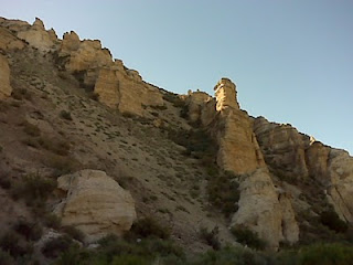
The place initially looked like home, with big coniferous trees and aspens, but the granite rocks and  prickly pear reminded me that I wasn't in Oregon.

The tent was more level than this picture makes it look. At least I didn't notice myself rolling in the night. It could be due to the fact that I had two dogs anchoring me in place. I wasn't cold at all, but they either had tired of sleeping on the ground and preferred me as a cushion or their spoiled and desert-accustomed bodies were chilly. Hard to say, but if anyone could have heard me in the night over the creek the conversation went a little like this: "Move. Lucy, dammit, move! Tate! Get off of me! Move! Grpphugh, NOT ONTO MY HEAD!"
 
The dogs survived the night, as did I, and the next morning was gloriously clear. This is what Wheeler Peak looks like from near my camp. It was the only view that I had stored in my childhood memory of the place until later when I drove up the "scenic drive." More on that in a minute. If you've never been to Great Basin National Park, GO. It is cheap to camp (It is ridiculous that I could stay here for $12 a night but I was stiffed $17 a night for a Nevada state park!), it provides some needed respite from the heat, since the lowest campground in elevation is 7,000 feet, and the above and belowground scenery is fantastic.  The mountains are obvious and grand, but there is a large cave system here as well. This time I didn't venture into Lehman Caves because I didn't want to leave the dogs, but I remember being astounded as a kid.  This is also where I learned the difference between stalactites and stalagmites. If you haven't been there and you find yourself hauling across highway 50, drop south a bit and go see it.

After supporting the local economy at the Lehman Caves visitor center ("Ooooh! Fossils in a bag! I must have them!  Damn, these came from the Confusion Range.  I just passed that!") the dogs and I drove up the Wheeler Peak scenic drive.  I didn't have any idea how high in elevation one can get, but I soon found out. The drive meanders and switchbacks its way around the northeast side of the mountain until it presents you with the following view at which point you realize that the campgrounds are on the boring side of the mountain.
 

 It seemed amazing to me that I could go from an expansive sage brush flat to this view in under 30 minutes. I also expected to hear yodels, but I resisted giving one of my own since the few people at the pulloffs already were eyeing me with suspicion.  I think it was my hat. Or possibly it was my heaving breaths as the elevation steadily increased.

 Finally, I reached the highest point one can drive.  There is a large parking lot and potty stop, but no oxygen tanks, so I didn't stay long. Kidding, I was only mildly hypoxic and I could barely tell the difference between the headache from altitude sickness and my normal day-to-day headaches.  There is a campground at this stop, which is roughly 10,000 feet in elevation. The view in the picture below is looking up at the 13,000+ ft peak. I had no urge to camp here, since listlessly sitting in a chair and reading a book is what I had been doing the previous day at 7,000 feet. It would have scared the ecohipsters to see me setting up a tent while periodically lying on the dirt gasping for breath. After taking pictures and marvelling at the elderly couple sitting on their tailgate smoking a cigarette, we departed for the lowlands.

That night, in celebration of surviving the mountain (it sounds like I scaled Everest rather than driving my sorry self up Wheeler) I decided to char a hotdog for dinner.  Mmmmm, healthy.

Next up: the long, long, long drive home.

Posted by Picasa

Thursday, June 24, 2010

Leaving Utah

After deciding against backtracking to camp at Cedar Canyon, the girls and I headed downhill from Cedar Breaks National Monument. The drop in elevation is, let's just say, quite swift. While negotiating numerous curves, four wheelers which I guess are now called "OHV's", and a LOT of condos in a place called Brian Head (I kid you not), I realized that the smell of burning brakes was coming from the poor old Ford. I geared way down and crawled back to the flat land of Utah, hoping to find something entertaining in Beaver. I had to go to Beaver, come on! Any graduate of Oregon State understands. You duck people can keep your comments to yourselves.

Unfortunately, by the time I got to Beaver, I was in the "must drive on, must drive on" mode and didn't stop other than to take this picture while traffic dodged me on the highway.


I had my sights set on a campground near Minersville, which sounded historic and promising.  Plus, the map showed a reservoir and I figured the dogs would appreciate a swim.  Unfortunately, once we go to the campground, we discovered that it essentially was a gravel parking lot with a section of fence providing a windbreak and scant separation from the next "site." Not only that, but the place was PACKED with people, all of whom seemed to know each other and look at my pickup expectantly as I crept through.  It appeared to be a family reunion of "OHV" and jetski enthusiasts.  The reservoir looked only slightly more inviting than a stock pond on the desert.  I made the snap decision to drive on, much to the annoyance of the dogs.  I have no pictures of the place, but the expression on Tate's face once we finally did stop for the night might be enough to register what they were feeling.  I call this her unhappy wombat face.


On we drove, hoping to find someplace level and quiet to throw down the tent.  If the wind had not been howling, I would have chosen a piece of dirt off the highway outside of Milford, Utah since I was getting delirious with fatigue at this point.  But, as the windfarm in Milford attests, it's a breezy spot.  We gassed up and I snapped a few pictures.  This first was a place across from the gas station.  Times are rough in Milford.  The combined cafe-jewelry-lapidary-taxidermy shop was closed down.  Can't say I would eat in a place that might have a motto of "If you can't wear it or eat it, we'll stuff it!"


 It could have been the road fatigue getting to me, but I also found this humorous. Looks like people in Milford have a knack for multipurposing a space. They also have an interesting aesthetic for paint jobs.


Through the long afternoon we drove, not finding anything suitable or attractive.  Finally I looked at the map and said "Screw it.  Girls, we're going to Wheeler Peak."   

Posted by Picasa

Wednesday, June 23, 2010

Cedar Breaks National Monument

The first view of Cedar Canyon


Cedar Breaks National Monument, worth every dollar of the $4.00 entry fee.

From the north rim looking south.  The rangers told me that the snow was several feet above the roof of the interpretrive center just six weeks ago.  It was a warm day when I was there and the snow was melting fast.

The drive up from Cedar City is gradual, but the climb does become more pronounced and eventually one realizes that the air is thin and exertion of any sort results in an odd elevation of the hearbeat, which is perplexing until this sign comes into view.  Then everything makes sense.

I thought the dogs would appreciate cooling off.  After being told to "stay!" several times for the picture, I think their hineys were cold, though.

I keep thinking that I might attempt watercolor painting again using this place as inspiration.  I know it will only end badly, but it's worth a shot.

Posted by Picasa

Tuesday, June 22, 2010

Irontown ruins in Utah

Though I am now home, I have mucho updates from the last few days of my ramble through Nevada and a bit of Utah.

First up, ruins of a place called Irontown. As we zipped along towards Cedar City, dodging sheep and the occasional car, I saw the sign and made the snap decision to go see it. The dogs also needed a stretch, so it seemed a timely stop.

Just a few miles off the highway, Irontown was an iron ore processing spot in the mid 1800's until it could be done more economically elsewhere. The literature at the place seemed to suggest that the untapped iron in the area will someday again become an important resource, once cheap overseas iron runs out.
There are a few remnants of buildings along a pretty little stream and pond. One standing charcoal oven, a rasse (for grinding sand from as much as I gathered), and foundations or walls of several buildings are visible along a short walk. The dogs found many lizards to entertain them while I read signs and took pictures.

It's a beautiful valley and there are current residents only yards from the ruins who live in a little slice of heaven. I ran into only one person while I was there and he had to ask me about my OSU t-shirt. Turns out he was from Portland and all of his kids went to U of O. Small world, eh?
Sent on the Sprint® Now Network from my BlackBerry®

Monday, June 21, 2010

Tired tired tired

Ely is a pit. Eureka is a cute little town. Austin looks interesting but I was too driven to push on to stop. Battle Mountain looks like a real town. Heading towards Winnemucca. Odds are I'll end up in Oregon for the night.
Sent on the Sprint® Now Network from my BlackBerry®

Out in BFE Utah

Just when you think the wind is whipping up yet another dust devil...
Sent on the Sprint® Now Network from my BlackBerry®

On the road

I've had either no signal or no luck in emailing the blog for several days. I have a huge backlog of pictures now. Ah well. We're on the way to Ely, NV for breakfast. Been at Wheeler Peak for a couple of days. More later!
Sent on the Sprint® Now Network from my BlackBerry®

Friday, June 18, 2010

Kershaw Ryan state park

Our stop at one of the many state parks in this area (each with its own entrance fee...that season pass woulda been a steal) gave all three of us some very relaxed shade time.

Kershaw Ryan S.P. Is named for some original landowners and ranchers who eventually gave the land to the state. The first owners planted fruit orchards and grape vines. The vines have taken over some of the canyon walls and there are still many fruit trees. Fantastically enough though, the little shaded end of the canyon is incredibly groomed with lawns, roses, group picnic areas, an arbor that is obviously used for small weddings, and a kids wading pool. I kid you not. You round a corner in a sweltering rock canyon and then hit this little oasis.

We were the only ones there for over two hours and the girls and I made good use of the grass for some shoes off-belly rubbing-shade loving naps. None of us waded in the pool. It's verboten for dogs and I figured it would be unfair to wade in front of them.
Sent on the Sprint® Now Network from my BlackBerry®

Rainbow Canyon rock formation.jpg

Today I explored south of Caliente (aptly named), NV. Ignoring the "road closed to all but local traffic" signs, the girls and I set out to find shale outcroppings that are purported to hold trilobite fossils. We didn't find them, but I did find several cool rocks that will migrate to Oregon.

Rainbow Canyon is a beautiful gorge that has a few ranches, a state park, a railroad track, and many washouts along the road. After waving at a train and maneuvering past some construction sites that are oddly quiet on a weekday, the girls and I bailed off on what looked to be a dirt road up a side canyon. Said road was really another sandy wash and I managed to turn the pickup around. It was a great place to let the girls run free for an hour (more lizards!) while I looked at rocks.

From there we went back to the state park, but that will have to wait because I'm doing laundry in Caliente and I know someone is going to steal my socks if I don't make an appearance at my machine.
Sent on the Sprint® Now Network from my BlackBerry®

First cool geocache goodie.jpg

I've gotten a bit intrigued by this geocaching thing. I downloaded a gps app for my phone and so far I've found four caches and hunted for another with no luck. This is positively a lazy pace for most geocachers, from what I've heard. But I really can't be bothered to hike a mile in the swelter to hunt for a film cannister.

Most of the ones listed around here seem to be as "log only" types, but I did find two with goodies. The deal is that if you take a goodie then you leave something else in its place. I left a guitar pick in exchange for a dollar bill (what? I need singles for the stinkin day use fees of Nevada parks!) and a breast cancer pin for the cool little Dutch shoe. I have a whole box of "treasures" that I sorted out at home before I left and I got apack of Oregon playing cards with variuous scenes depicted. I'm ready to leave some goodies! Now if my phone could just get a reliable signal... Something tells me that I'll put a real gps unit on a birthday hint list this year. :)

Much love to all.
Sent on the Sprint® Now Network from my BlackBerry®

Things I'm thinking about in the middle of the night

It's past midnight and there is no good reason I should be awake. I walked further on a sandy trail than I have in a year, I was busy all day, I haven't had coffee since 7 am. But here I am.

Today, or yesterday rather, I watched a whiptail lizard devour a caterpillar. Its head was shaped just like the raptors in Jurassic Park. I also saw one slither out of a hole in the ground that I would have assumed was a snake hole. And lizard turf battles are a hoot to observe.

In a little spot called Eage Valley I bought a pop and lantern mantles. The store was a combination RV park office/grocery/bar/casino. The patrons in the bar looked like they'd been there a while and had nowhere pressing to be any time soon. I had no urge to cut through the cigarette smoke just to play a slot machine. Then and there I made the decision that this trip to Nevada would not include gambling. Not too hard to do this close to Utah, really.

It feels odd to be in so much contact with the world in a one-way manner while out on a camping trip. Somehow it feels like cheating or just hiding from home but doing nearly the same web surfing as always.

The dogs are so tired tonight. I wish I could sleep as hard as they are right now. They had a big day of hiking, lizard lunging, and swimming at Echo Canyon state park. I'll sign off with a picture that illustrates my impression of the reservoir there. Good night, I hope.
Sent on the Sprint® Now Network from my BlackBerry®

Thursday, June 17, 2010

The Afternoon Excursion

After the dogs decided that I brought them to a hellish place inhabited by crawly things but with no water, I decided to venture north to Pioche.

Pioche was a lawless mining town from the 1860's to the turn of the century. With a description in the guidebooks as a place that buried over 70 people in the "Murderers Row" of the cemetery, I had to see it. The Boot Hill cemetery backs up to a manicured cemetery that is filled with seemingly more respectable folk. One glance at the lawn with "So and so Plus Mrs So and so...sealed in 1980" convinced me that the LDS plots were probably not where the interesting epitaphs were to be found.

I headed for the sage and weed section and wasn't disappointed. There I found an abundance of old stone markers which erosion has erased, rusted iron railings around plots with stones from the 1800's, numerous unmarked graves which were apparent to the well trained eye of this former cemetery worker, and murderers row. The graves in the row are separated by a fence from the rest and it's clear that the current townsfolk of Pioche know a tourism gifthorse when they see one. The headstones are boards with names and epitaphs chiseled in and burnt with a woodworking tool of some sort (probably reminiscent of the ones my brothers had when we were kids.) Rocks ring each grave, which is mounded with dirt. (After over a hundred years, you'd think they'd be flat...) Fake plastic flowers adorn each, which I'm sure the crusty old miners would have appreciated horribly. And finally, an old weathered boot lies at the base of each marker, as if to remind the observer of the name of the place. I found myself amused but a bit skeptical. I did enjoy the epitaphs and hope that the original markers had the same lines at one time. One gentleman was shot over a dog, another's name wasn't known but had been shot by a coward, a third died by fire (gun or flame?) and the lone female (a prostitute) was killed by a lover. The last line in her marker reads "Damn shame."

I guess I can't blame the curreent residents of Pioche for trying to keep the history and tourism it brings alive. The mines have played out (and the hills are pockmarked with shafts. It's amazing.) The antique business looked to be slow while I was there. Other than the school, courthouse (the new one...not the million dollar one of its history), jail (there's law in Pioche now!), and post office I'm not sure what other industry is keeping Pioche alive. So, I got over myself and supported the local economy by having a sourdough burger at the Silver Cafe. Mmmm, good.
Sent on the Sprint® Now Network from my BlackBerry®

The Morning Walk

This morning we took the four mile loop through Cathedral Gorge. The girls were uninterested until they realized lizards were everywhere. It was a good workout trying to keep them on the trail. Luckily we didn't see any snakes.

The desert is in bloom and I wish Mom could see all of the flowers, most of which I don't know the names. I think I identified Mormon Tea from a trail sign though. No wonder those Mormons were industrious about settling the desert...the stuff is packed with ephedra.

It was a beautiful walk and I managed several pictures with my real camera that I will have to upload when I get home.
Sent on the Sprint® Now Network from my BlackBerry®

good morning.jpg

The wind stopped howling through the canyon, I had a shower (whew, much needed), slept exceedingly well, and the morning coffee is on the brew. I think I'll stay here another night.
Sent on the Sprint® Now Network from my BlackBerry®

Wednesday, June 16, 2010

good night moon.jpg

Sent on the Sprint® Now Network from my BlackBerry®

Random things from today

1. Gabbs is a plucky little mining town whose school mascot is apparently the Tarantulas. At least the mural on the side of the school said "Tarantula Power!" Maybe it's someone trying to unionize the arachnids.
2. I have no idea what brucite is, but it seems to be worth mining.
3. Whiptail lizards have exceedingly long tails. Whaddya know!
4. If there are any aliens hiding out along the "Extraterrestrial Highway" they must look a lot like cows.
5. Given a camground within 2 miles of a highway there will always be a "loud crowd" with obnoxious kids, men with shaved heads, women who must yell their every though, craptastic music playing loud enough for all to "enjoy" and at least one overworked generator.
6. Given said loud crowd, I will camp in full sun amidst blowing sand just to be on the opposite side of the camp.
7. Even if it has been 90 degrees, the second the shadows lengthen and the temperature drops, I think I'm cold. But then I'm hot when I put the fleece on.
8. I'm having a great time. Love to all.
Sent on the Sprint® Now Network from my BlackBerry®

Cathedral Gorge.jpg

I made to just outside of Panaca, NV for night 3. This is Cathedral Gorge State Park. Pretty cool erosion forces at work. Tomorrow the girls and I will walk some trails and see what the fort-like structure is all about.

Wish me luck---the wind is howling. The only good thing about that is that I think it's keeping the blackflies at bay a tiny bit. I know I need a shower, but sheesh!!
Sent on the Sprint® Now Network from my BlackBerry®

Just a hillside.jpg

One thing I'm appreciating on this trip is the colors. This picture doesn't do it justice, but so much variety. Pink, orange, white, gray, charcoal black...all in contrast to the blue sky.
Sent on the Sprint® Now Network from my BlackBerry®

Ore tracks into the mill.jpg

Sent on the Sprint® Now Network from my BlackBerry®

In the ore mill.jpg

Truly incredible old machinery. Two men worked the machines that ran the mill and processed the ore.
Sent on the Sprint® Now Network from my BlackBerry®

Machine shop.jpg

The old truck outside needed some work.
Sent on the Sprint® Now Network from my BlackBerry®

Seat with a view.jpg

Sent on the Sprint® Now Network from my BlackBerry®